Executive Summary
High resolution holocene paleoclimatic and paleoceanographic
records from small lakes and anoxic basins along the British Columbia
coast.
Earth's climate is highly variable, and this natural variability
must be understood if reliable predictions of future climate states
are to be made. Geological and historical records from coastal B.C.
provide clear evidence that the regional climate has oscillated
on a variety of time-scales during the Holocene interglacial (0-10,000
years before present). The present climate of the west coast of
Canada is influenced by the Aleutian Low, the Jet Stream, and El
Niño/La Niña, which are interdependent and have sub-decadal
cycles. Superimposed in these cycles are less well understood, regionally
modified, longer-scale events operating on a global scale. The interactions
of these climate-forcing phenomena determine whether there will
be costly droughts or flooding on land, and influence recruitment
to many BC fisheries. This is because changes in the wind system
influence oceanic upwelling, and alongshore drift, which can result
in modifications to plankton distribution and abundance. The purpose
of this research is to identify past changes in atmospheric and
ocean conditions, and the relative timing of these changes, over
the last 2,000 years from the sedimentary record in coastal BC inlets
and lakes. This information is required by policy makers attempting
to recognize and adapt to anthropogenic climate change. Recognition
of the natural climatic cycles affecting the coastal ocean will
also enable the commercial marine fishing industry to respond more
strategically to natural variations in fish stocks.
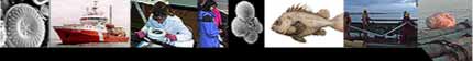
Annually deposited, finely laminated sediments laid down in inlets
with little or no bottom water oxygen content along southern Vancouver
Island, contain a high-resolution record of climate change and paleoproductivity
in the Coastal Upwelling Domain throughout the late Holocene, and
have been previously studied by the coinvestigators. A reconnaissance
cruise aboard the CCGS Vector in August 2000, carried out in anticipation
of this CFACS application, found additional inlets with annually
laminated sediments in Smith, Seymore, and Belize inlets and Frederick
Sound, in the Coastal Transition Domain. We will sample all these
sites, together with adjacent lakes, and utilize a combination of
oceanographic, sedimentological, geochemical, and micropaleontological
methods to identify and correlate long and short-term climate cycles
for the entire region, impossible to resolve with the short, approximately
100-year instrument record. We will also determine the impact of
coastal marine climate changes on the productivity and distribution
of pelagic fish stocks along the B.C. coast by examining fish scales
that are well preserved in core samples.
This project will be carried out by researchers from Carleton Univ.,
Univ. of Victoria, Univ. of British Columbia, Laval Univ., and McMaster
Univ. in cooperation with researchers from the Institute of Ocean
Sciences, DFO; Pacific Geoscience Centre (PGC), GSC; Terrain Sciences
Division (TSD), GSC, and the Pacific Marine Environmental Laboratory
(PMEL), NOAA. The investigators have been in the forefront of paleoceanographic
research in their various subdisciplines and most have worked together
on a soon to be completed NSERC Strategic Project Grant that emphasized
paleoproductivity in the Coastal Upwelling Domain. Principal Investigator
Patterson will administer the CFCAS grant, but other members of
the team will take leading roles according to expertise. Due to
the complex interdisciplinary (micropaleontological/ sedimentological/
geochemical/ cyclostratigraphic/ oceanographic) nature of this proposal,
Patterson will also devote a significant portion of his time to
running the project. Effective communication will be essential to
monitoring the progress of such a multidisciplinary project, and
will comprise several group meetings, extensive use of e-mail, and
posting of collected data to a project www site.
Several research cruises are planned over the course of the grant
to visit these anoxic inlets and coastal lakes to collect cores,
redeploy sediment traps and moored sensors, as well as collect seismic
and other oceanic telemetry using DFO provided ships, the CCGS
Vector and CCGS JP Tully. DFO will also provide a wide
array of oceanographic sensors, sampling devices, and technical
assistance. PGC will provide access to powerful subbottom profiling
equipment and infrastructure for us to core coastal lakes where
corroborative continental climate records are archived, in addition
to facility use and technical assistance. PMEL/NOAA will provide
loan of moored sediment traps for the duration of the project. TSD/GSC
will provide access to their core X-ray facility.
|